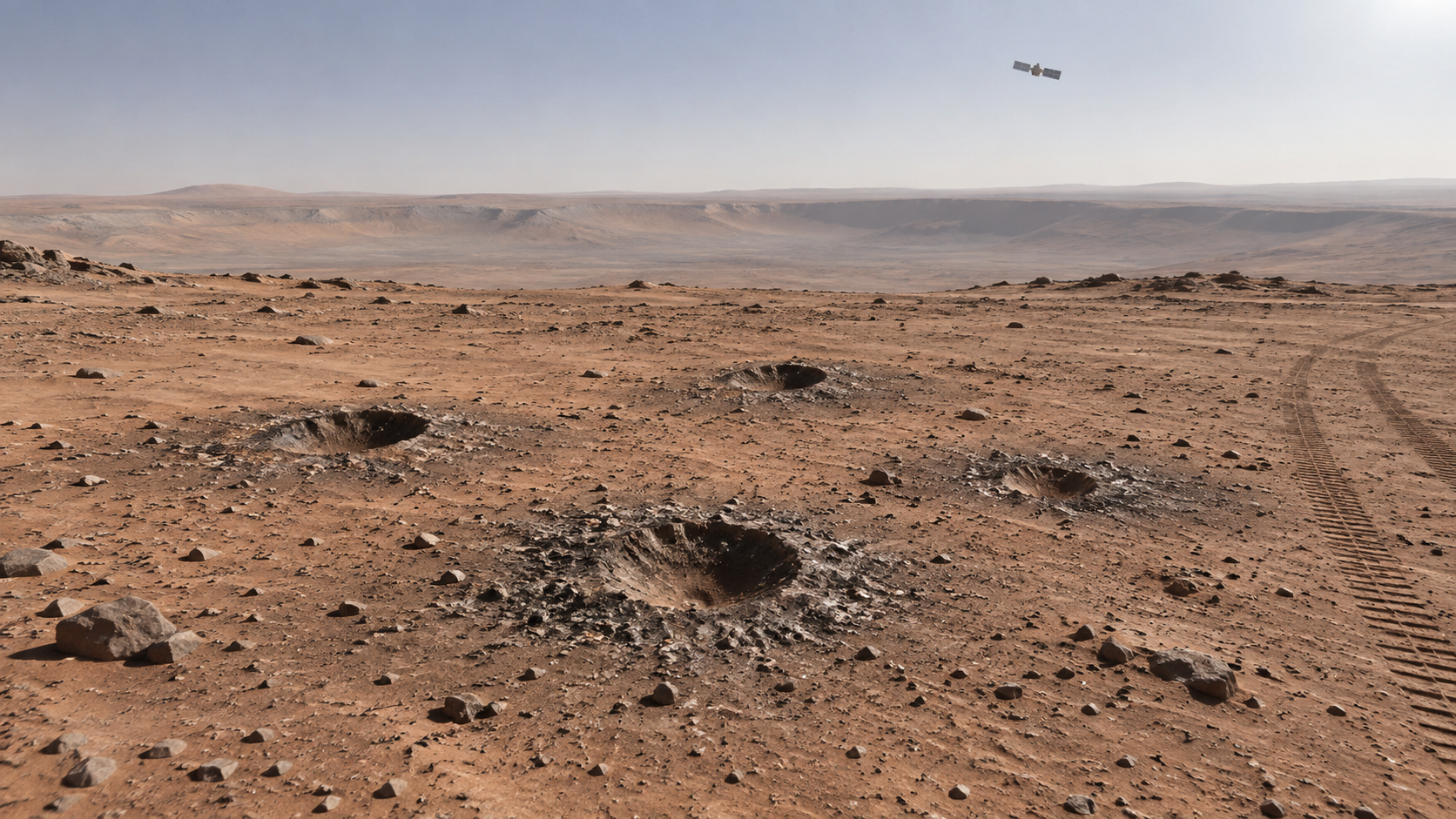
Several small craters on Mars were left by hardware released from a NASA lander. During its approach, the spacecraft discarded ballast and other landing-system components; years later, orbital images made it possible to inspect the marks where they hit the surface. 3DNews and ScienceAlert reported the finding on September 19.
The interesting part is not a crash or a new launch. The spacecraft was expected to shed unneeded mass before landing. The unexpected benefit was scientific: the shape and depth of the marks gave researchers another clue to the structure of the upper layer of soil at the impact site.
What the images show
The images show small fresh depressions surrounded by dark ejecta. The study describes five distinct marks. The components struck at shallow angles, producing elongated, irregular traces rather than one deep, symmetrical crater.
For planetary scientists, such marks matter because an impact acts as a very rough probe. Its geometry reflects not only the mass and speed of the fragment, but also the density, layering and strength of the regolith — the dust, sand and rock fragments covering Mars.
Why this is not drilling
A crater from a falling component does not provide a rock sample or directly measure chemistry. Researchers also lack full control over the impact: the parts’ shape, entry angle and surface condition all affect the outcome. These images cannot establish the presence of water or determine whether a specific site is suitable for landing.
They can help test models. Before landing, engineers and scientists estimate soil properties from orbital data; afterwards they can compare those calculations with a real impact trace. For future missions this is practical information: loose ground affects landing legs, rover wheels and drilling equipment.
The key caveat: the published work interprets crater shapes. It does not prove soil composition or turn an accidental impact into a full subsurface investigation.
Why images can arrive years later
Mars orbiters photograph only limited strips of the planet and cannot continuously watch every point. A useful image needs the right orbit, lighting and observation command, followed by comparison with earlier frames. A landing event can therefore receive a new interpretation much later.
High Resolution Imaging Science Experiment (HiRISE) images from the Mars Reconnaissance Orbiter and its public archive provide the primary observations for work of this kind. Editorial reports describe the scientific interpretation; they do not replace the underlying data.
What it changes
The story shows why long observation records matter to space missions. Even routinely discarded ballast can leave a measurable trace if an orbiter has enough resolution and a team can compare images with calculations.
NASA did not discover a new resource or learn to collect samples by impact. It gained another indirect clue about the mechanics of the upper surface layer. In planetary geology, such clues gradually reduce the risk of future landings, but rarely supply one final answer.
Bottom line
A handful of small Martian craters proved more useful than expected: they helped test assumptions about loose near-surface soil. The result is not a sensation but a method — connecting accidental impact traces to long-running orbital observations.